Patna
Patna, historically known as Pataliputra, is the capital and largest city of the state of Bihar in India. According to the United Nations, as of 2018, Patna had a population of 2.35 million, making it the 19th largest city in India. Covering 250 km2 and over 2.5 million people, its urban agglomeration is the 18th largest in India. Patna serves as the seat of Patna High Court. The Buddhist, Hindu and Jain pilgrimage centres of Vaishali, Rajgir, Nalanda, Bodh Gaya and Pawapuri are nearby and Patna City is a sacred city for Sikhs as the tenth Sikh Guru, Guru Gobind Singh was born here. The modern city of Patna is mainly on the southern bank of the river Ganges. The city also straddles the rivers Sone, Gandak and Punpun. The city is approximately 35 km in length and 16 to 18 km wide.
One of the oldest continuously inhabited places in the world, Patna was founded in 490 BCE by the king of Magadha. Ancient Patna, known as Pataliputra, was the capital of the Magadh Empire through Haryanka, Nanda, Mauryan, Shunga, Gupta and Pala dynasties. Pataliputra was a seat of learning and fine arts. It was home to many astronomers and scholars including Aryabhata, Vātsyāyana and Chanakya. During the Maurya period (around 300 BCE) its population was about 400,000. Patna served as the seat of power, and political and cultural centre of the Indian subcontinent during the Maurya and Gupta empires. With the fall of the Gupta Empire, Patna lost its glory. It was revived again in the 17th century by the British as a centre of international trade. Following the partition of Bengal presidency in 1912, Patna became the capital of Bihar and Orissa Province.
Until the 19th century it was a major trading and commercial hub in India. After independence there were a few downturns but its economy was still stable. After the separation of Jharkhand from Bihar, it lost its glory. Now trials are made to develop the city. As per the Directorate of Economics and Statistics (Government of Bihar), Nominal GDP of Patna District was estimated at INR 63,176.55 crores in 2011-12. As of 2011-12, Patna already recorded per capita gross domestic product of ₹1,08,657, way ahead of many other Indian cities and state capitals. Using figures for assumed average annual growth, Patna is the 21st fastest growing city in the world and 5th fastest growing city in India according to a study by the City Mayors Foundation. Patna registered an average annual growth of 3.72% during 2006–2010. As of 2011-12, GDP per capita of Patna is ₹1,08,657 and its GDP growth rate is 7.29 per cent. In June 2009, the World Bank ranked Patna second in India (after Delhi) for ease of starting a business.
The name of this city has changed with time. One of the oldest cities of India, there are several theories regarding the origin of the modern name Patna (Bengali: পাটনা; Devanagari: पटना; Kaithi: ????; Gurmukhi: ਪਟਨਾ; Urdu: پٹنہ). It is etymologically derived from Patan (Devanagari: पटन), the name of the Hindu goddess, Patan Devi. Patan Devi Mandir is still in old Patna near Gulzarbagh mandi along with another, Patan Devi Mandir, near Takht Sri Patna Sahib. Many believe Patna derived its name from Patli, a tree variety that was found in abundance in the historic city. It is also seen on the state tourism's logo. The place is mentioned in Chinese traveller Fa Hien's records as Pa-lin-fou. The city has been known by various names through more than 2,000 years of existence – Pataligrama, Pataliputra, Kusumapura, Kusumdhwaja Pushpapuram, Padmavathi, Azimabad and the present-day Patna. Legend ascribes the origin of Patna to the mythological King Putraka who created Patna by magic for his queen Patali, literally "trumpet flower", which gives it its ancient name Pataligrama. It is said that in honour of the queen's first-born, the city was named Pataliputra. Gram is Sanskrit for village and Putra means son. Legend also says that the Emerald Buddha was created in Patna (then Pataliputra) by Nagasena in 43 BCE.
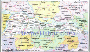
Map - Patna
Map


Country - India
 |
 |
| Flag of India | |
Modern humans arrived on the Indian subcontinent from Africa no later than 55,000 years ago. Their long occupation, initially in varying forms of isolation as hunter-gatherers, has made the region highly diverse, second only to Africa in human genetic diversity. Settled life emerged on the subcontinent in the western margins of the Indus river basin 9,000 years ago, evolving gradually into the Indus Valley Civilisation of the third millennium BCE. By, an archaic form of Sanskrit, an Indo-European language, had diffused into India from the northwest. (a) (b) (c), "In Punjab, a dry region with grasslands watered by five rivers (hence ‘panch’ and ‘ab’) draining the western Himalayas, one prehistoric culture left no material remains, but some of its ritual texts were preserved orally over the millennia. The culture is called Aryan, and evidence in its texts indicates that it spread slowly south-east, following the course of the Yamuna and Ganga Rivers. Its elite called itself Arya (pure) and distinguished themselves sharply from others. Aryans led kin groups organized as nomadic horse-herding tribes. Their ritual texts are called Vedas, composed in Sanskrit. Vedic Sanskrit is recorded only in hymns that were part of Vedic rituals to Aryan gods. To be Aryan apparently meant to belong to the elite among pastoral tribes. Texts that record Aryan culture are not precisely datable, but they seem to begin around 1200 BCE with four collections of Vedic hymns (Rg, Sama, Yajur, and Artharva)."
Currency / Language
| ISO | Currency | Symbol | Significant figures |
|---|---|---|---|
| INR | Indian rupee | ₹ | 2 |
| ISO | Language |
|---|---|
| AS | Assamese language |
| BN | Bengali language |
| BH | Bihari languages |
| EN | English language |
| GU | Gujarati language |
| HI | Hindi |
| KN | Kannada language |
| ML | Malayalam language |
| MR | Marathi language |
| OR | Oriya language |
| PA | Panjabi language |
| TA | Tamil language |
| TE | Telugu language |
| UR | Urdu |